The Government of Canada and the Royal Government of Cambodia signed a memorandum on May 8, 2000, to conduct a National Level 1 Survey (NL1S) to identify mine and UXO-contaminated areas in Cambodia. The survey revealed that 4,544 km² of land in 1,641 villages were contaminated, affecting 124,427 families. Based on these findings, CMAC initiated technical surveys and land release activities to address these hazards. Over time, CMAC's approach evolved, incorporating new methodologies and technical assistance from international organizations.
In 2006, a standardized national land release policy was developed to more accurately identify hazardous areas and release non-hazardous land. By 2009, CMAC had developed a Non-Technical Survey (NTS) process to support planning and land release activities. By late 2010, CMAC formalized its technical survey procedures, significantly improving land release outputs to around 100 km² per year from 2010 onwards.
In 2022, CMAC conducted the Baseline Survey in several provinces, covering over 51 km² and marking 549 minefields and UXO fields. This ongoing effort has been a significant step forward in Cambodia's mine action sector, enhancing the efficiency and effectiveness of land release operations.
Minefield marking is intended to warn people of hazardous areas and to prevent accidents by people in vulnerable communities, newcomers, and travelers entering mined or suspected areas, as well as to support large-scale mine clearance[YA1].
Baseline Survey is a survey activity undertaken to collect and analyze data on the presence, type, distribution and environment of mine/ Explosive Remnants of War (ERW) contamination in order to better define where mine/ERW contamination is and is not present and to support planning, prioritization and decision-making processes. Baseline Survey will proceed by using three main land classification categories:
- Classification A: Mined Area (Land that presents evidence of mines)
- Classification B: Residual Threat (Land that presents evidence of ERW or an indeterminate presence of mines)
- Classification C: End State Land (Land that presents no obvious threat)
Non-Technical Survey is to confirm whether there is evidence of a hazard or not, to identify the type and extent of hazards and to define, as far as is possible, the perimeter of the suspect hazardous areas without physical intervention.
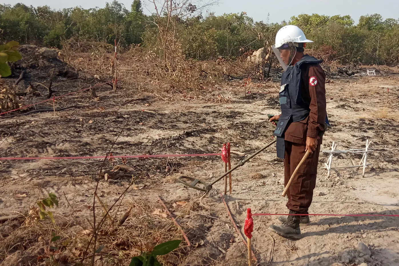
Technical Survey is a process with physical entry into a hazardous area to obtain enough information to make an informed assessment of the need for clearance. While a technical survey can be a separate activity, it is often integrated in a clearance process and can be conducted before or during clearance. A technical survey should confirm the presence of mines/ERW, leading to further definition of the land using the land classification standard.
[YA1]Newly added

Land Release is a process of applying all reasonable efforts to identify, define, and remove any presence and suspected contamination of mines/Explosive Remnants of War (ERW) by: Non-Technical Survey, Technical Survey, and/or Clearance.
Information management is an essential part of all mine action activities. It refers to the process of continuously identifying information needs and collecting, analyzing, and providing timely information to relevant mine action stakeholders. This includes support to non-mine action organizations such as donors, governmental organizations, local authorities, local communities, surveyors, and other development activities. Efficient information management ensures that mine action managers and other stakeholders have access to information when making decisions.